


Voting District 160012, Broome County, New York
About
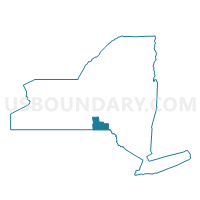
Outline

Summary
| Unique Area Identifier | 625589 |
| Name | Voting District 160012 |
| County | Broome County |
| State | New York |
| Area (square miles) | 7.45 |
| Land Area (square miles) | 7.44 |
| Water Area (square miles) | 0.01 |
| % of Land Area | 99.84 |
| % of Water Area | 0.16 |
| Latitude of the Internal Point | 42.02063120 |
| Longtitude of the Internal Point | -76.02377550 |
Maps


Graphs
Select a template below for downloading or customizing gragh for Voting District 160012, Broome County, New York


Neighbors
Neighoring Voting District (by Name) Neighboring Voting District on the Map
- Voting District 160002 160022, Broome County, NY
- Voting District 160004, Broome County, NY
- Voting District 160007, Broome County, NY
- Voting District 160010 160011 160017, Broome County, NY
- APOLACON TWP Voting District, Susquehanna County, PA
- CHOCONUT TWP Voting District, Susquehanna County, PA
Top 10 Neighboring County Subdivision (by Population) Neighboring County Subdivision on the Map
- Vestal town, Broome County, NY (28,043)
- Choconut township, Susquehanna County, PA (713)
- Apolacon township, Susquehanna County, PA (500)
Top 10 Neighboring Unified School District (by Population) Neighboring Unified School District on the Map
Top 10 Neighboring State Legislative District Lower Chamber (by Population) Neighboring State Legislative District Lower Chamber on the Map
- Assembly District 126, NY (131,765)
- State House District 111, PA (59,947)
- State House District 110, PA (59,579)